Small boats present unique navigation challenges. Whether you operate a jon boat, kayak, PWC, or small fishing skiff, you’re working with limited dashboard space, tight budgets, and no desire for permanent wiring or professional installation. Traditional dedicated chartplotters still serve certain purposes, but the marine navigation landscape has transformed significantly. Smartphone and tablet apps now deliver professional-level navigation using devices you already own, eliminating hardware costs while often providing superior features.
This comprehensive comparison examines the best chartplotter options for small boats, from compact hardware units to modern navigation apps. The verdict: while entry-level hardware like the Garmin Striker Vivid series offers a solid foundation, a modern navigation app like Wavve Boating provides superior flexibility, features, and value for most small-boat owners, with zero hardware investment required.
What Makes a Good Chartplotter for Small Boats?
Portability and Installation Requirements
Small boats lack the dashboard space and electrical infrastructure that larger vessels provide. The ideal chartplotter for small boats either mounts easily without permanent installation or eliminates mounting entirely by using devices you already carry. Kayaks, jon boats, and PWCs particularly benefit from solutions requiring no wiring, drilling, or professional installation.
Hardware chartplotters demand permanent mounting brackets, power connections, and often transducer installation through the hull or transom. This commitment makes sense for dedicated fishing boats but feels excessive for recreational small-boat operators who value simplicity and portability.
Total Cost Considerations
Budget constraints often drive small-boat purchases, and navigation equipment budgets follow the same logic. Hardware chartplotters cost $200-500 upfront, plus periodic chart update fees and potential installation costs. Subscription-based apps spread costs over time, typically $15-60 annually, while providing continuous automatic updates.
For small-boat operators planning infrequent trips or seasonal use, affordable navigation solutions that avoid large upfront investments make financial sense. The total cost over three to five years heavily favors app-based solutions for most recreational users.
Screen Flexibility and Size
Hardware chartplotters for small boats typically offer 3.5-7 inch screens. While waterproof and sunlight-readable, these displays feel cramped when viewing detailed charts or planning complex routes. Smartphones range from 5-6.7 inches, while tablets offer 10-12 inch displays, all providing superior resolution and touch responsiveness compared to budget chartplotter screens.
The ability to choose your screen size based on trip requirements, phone for minimalist kayak fishing, tablet for family bay cruising, delivers flexibility hardware units can’t match. Modern marine apps work seamlessly across device sizes, syncing data between your phone and tablet automatically.
Chart Quality and Safety Features
Official nautical charts form the foundation of safe navigation. The best chartplotter for small boats provides access to authoritative hydrographic data from organizations like NOAA, Canadian Hydrographic Service, and similar agencies worldwide. Beyond base charts, essential safety features include depth shading, tide predictions, weather overlays, and route planning tools.
Small boats often navigate shallow waters where understanding depth relative to your vessel’s draft becomes critical. Draft-aware depth visualization, automatically color-coding safe versus shallow water based on your specific boat, represents a significant advancement that traditional chartplotters rarely provide.
Offline Capability and Updates
Marine navigation must function beyond cell coverage. Whether exploring remote coves or venturing offshore, your chartplotter needs offline capability with downloaded charts accessible without internet connectivity. GPS operates independently of cellular service, allowing position tracking even in remote areas.
Chart updates present another consideration. Hardware units require purchasing new chart cards or paying update subscriptions, while app-based systems include continuous automatic updates within their annual fees. This difference becomes significant over multi-year ownership periods.
Ease of Use
Recreational small-boat operators want intuitive navigation, not steep learning curves requiring manual study. The best chartplotter for small boats provides clear, understandable displays and simple controls accessible while underway. Touch interfaces on modern smartphones feel more natural than button-based hardware navigation systems.
Understanding marine navigation basics helps regardless of platform choice, but intuitive design reduces the knowledge barrier for weekend boaters and casual users.
Top Chartplotter Options Compared
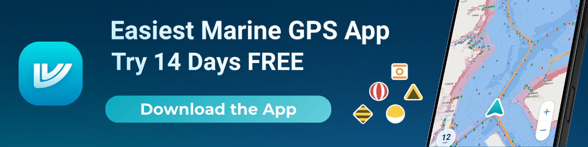
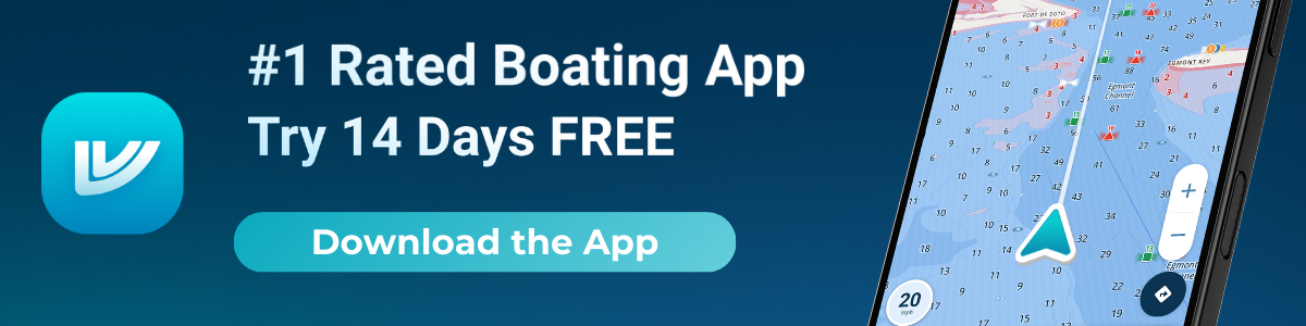
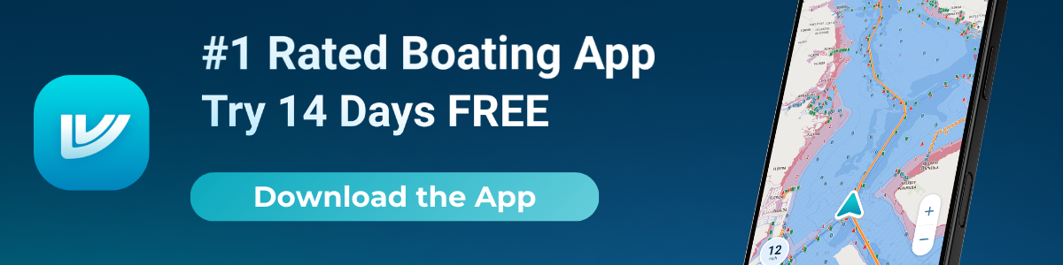
Wavve Boating: Comprehensive App-Based Navigation
Price: $69.99/year or $11.99/month subscription
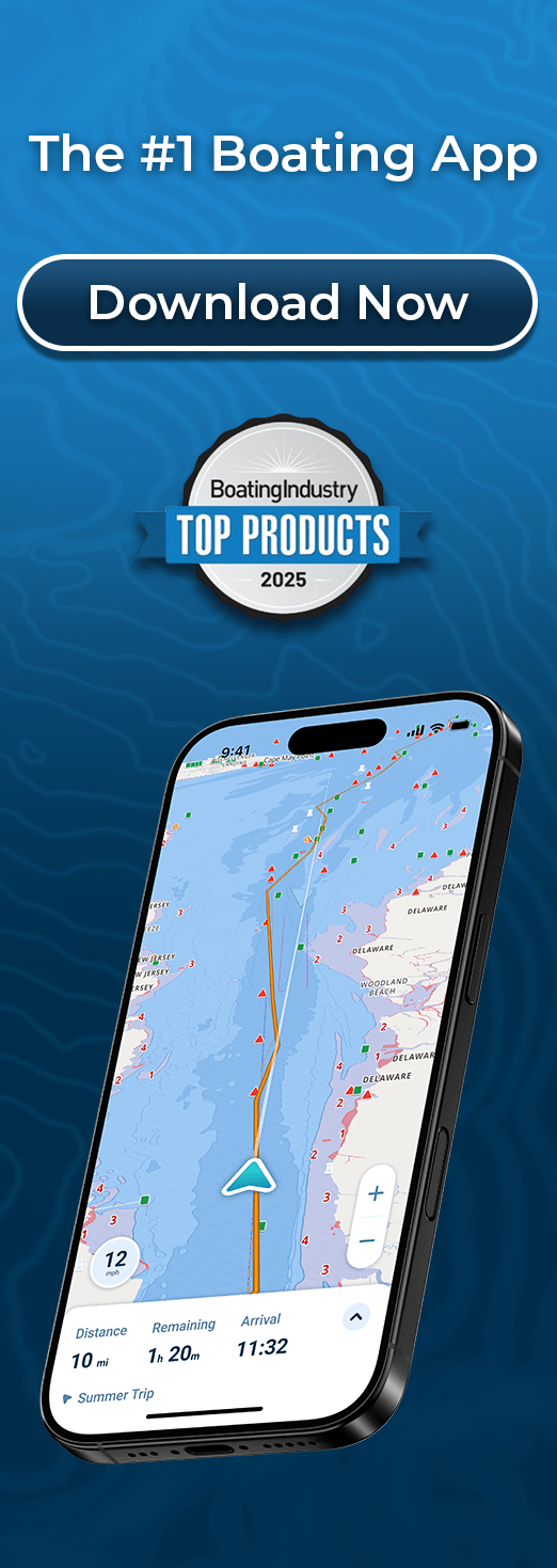
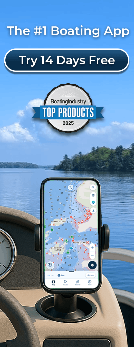
Wavve Boating represents modern marine navigation designed specifically for recreational boaters. The platform combines official nautical charts with real-time intelligence and safety features that traditional chartplotters and basic apps don’t provide.
Key Features:
- 17,000+ official nautical charts worldwide (NOAA, CHS, AHO, UKHO)
- Automatic draft-aware depth shading (color-codes safe/shallow based on your boat)
- Real-time tide integration (depths adjust automatically for current water levels)
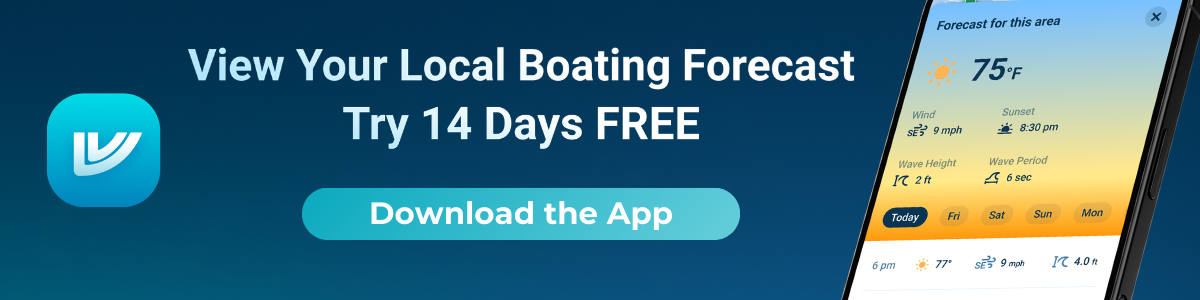
- 7-day marine weather and wave forecasts (layered directly on charts)
- Community hazard reporting (real-time updates from active boaters)
- Smart autorouting (considers draft and current conditions)
- Complete offline functionality (downloaded charts work beyond cell service)
- Track recording and route planning
- Works on iOS, Android, and integrates with Sea-Doo displays
Why It Excels for Small Boats:
Wavve eliminates hardware entirely, use your existing phone or tablet instead of dedicating dashboard space to fixed units. The draft-aware depth shading automatically highlights safe water in blue and shallow areas in red based on your specific vessel’s draft plus current tide levels. This feature alone prevents grounding incidents that plague small-boat operators in unfamiliar shallow waters.
Integrated weather forecasts appear directly on your planned route, showing hourly conditions for the next week. Community reports from other boaters provide real-time hazard warnings and favorite spot sharing that official charts can’t capture. Everything works offline after downloading relevant chart regions.
Cost Advantage:
At $69.99 annually, Wavve costs less than one-third of entry-level hardware chartplotters while delivering superior features. Over three years, you spend $180 total versus $200-300 hardware plus $50-100 in chart updates, saving money while gaining better functionality.
For small boats requiring shallow water navigation capabilities, the draft-aware features provide safety margins traditional systems can’t match.
Garmin Striker Vivid 4cv: Budget Hardware Option
Price: $200-$250 (one-time purchase)
The Garmin Striker Vivid 4cv represents entry-level dedicated marine electronics. This compact unit combines a 4.3-inch color display with CHIRP sonar, ClearVü imaging, and basic GPS functionality. The Vivid series improves on earlier Striker models with enhanced color palettes and better sunlight readability.
Key Specifications:
- 4.3-inch display (272 x 480 pixels)
- CHIRP traditional sonar plus ClearVü down-imaging
- High-sensitivity GPS with waypoint marking
- Quickdraw Contours mapping (create custom depth maps)
- IPX7 waterproof rating
Strengths:
The Striker Vivid 4cv excels at its primary purpose: fishfinding. The CHIRP sonar and ClearVü provide excellent underwater imaging for locating structure and fish. The compact size fits small boat dashboards or kayak mounts. Build quality is solid, and the unit handles marine environments reliably.
Limitations:
The small fixed screen feels cramped when viewing charts or planning routes. Built-in charts are basic, NOAA charts and detailed mapping require separate LakeVü or BlueChart card purchases (additional $100-200). The unit requires mounting hardware, 12V power connection, and transducer installation. No automatic tide integration or draft-based depth shading exists. Weather information requires separate devices.
Best For: Anglers prioritizing sonar over navigation, small fishing boats with 12V power available, users comfortable with basic chart detail.
For detailed analysis of this unit’s capabilities and limitations, our Garmin Striker review covers performance specifics.
Lowrance Hook Reveal 4x: Alternative Hardware Choice
Price: $200-$300 (one-time purchase)
Lowrance’s Hook Reveal series competes directly with Garmin’s Striker lineup. The 4x model provides 4-inch display, SplitShot sonar (combining traditional and down-imaging), and basic GPS navigation with preloaded US lake maps.
Strengths:
Simple setup and user-friendly interface make the Hook Reveal approachable for beginners. SplitShot sonar delivers good underwater detail. The unit performs well in shallow water applications common with small boats.
Limitations:
Similar constraints to the Garmin Striker: small fixed screen, installation requirements, basic chart detail without add-on purchases, no dynamic tide adjustments or vessel-specific depth awareness. Chart updates require purchasing new map cards.
Best For: Lowrance ecosystem users, anglers wanting combined GPS/sonar in one compact unit, boats with existing 12V infrastructure.
Navionics Boating App: Popular App Alternative
Price: $49.99/year subscription
Navionics Boating (now Navionics by Garmin following corporate acquisition) provides comprehensive charting through smartphone and tablet apps. The platform has served recreational boaters for years with detailed nautical charts and community-sourced data.
Key Features:
- Detailed NOAA-based charts with regular updates
- SonarChart HD bathymetry (community depth data)
- Dock-to-dock autorouting
- Tide and current predictions
- ActiveCaptain community points of interest
- Offline chart downloads
- Route planning and sharing
Strengths:
Chart detail is excellent, particularly in well-traveled waters where SonarChart HD provides 1-foot contour detail. The ActiveCaptain community contributes marina information, hazard reports, and local knowledge. The app works across iOS and Android platforms.
Limitations:
Navionics doesn’t automatically adjust depth displays based on your vessel’s draft, you manually interpret whether charted depths are safe for your boat. Real-time tide information displays separately rather than integrating with chart depths. Weather overlays are basic. At $49.99 annually, the cost exceeds some competitors while providing fewer integrated features.
Detailed pricing information is available in our Navionics cost guide.
C-MAP App: Affordable App Option
Price: $14.99/year premium subscription
C-MAP offers budget-friendly mobile navigation through clean vector charts and worldwide coverage. The low annual cost appeals to recreational boaters wanting basic charting without premium pricing.
Strengths:
At $14.99 annually, C-MAP premium represents the lowest-cost option among major marine navigation apps. The interface is clean and uncluttered. Worldwide chart coverage under one subscription eliminates regional purchase requirements. Offline downloads work reliably.
Limitations:
Lacks integrated real-time tide adjustments or automatic draft-based depth shading. Weather overlays are basic. Community features are limited compared to platforms with larger user bases. The app works adequately for basic navigation but misses advanced features that enhance safety and convenience.
Our C-MAP pricing analysis details the full feature set and value proposition.
Head-to-Head Comparison
| Option | First Year Cost | Installation Required? | Screen Flexibility | Draft-Aware Depths | Real-Time Tides | Best Suited For |
| Wavve Boating | $69.99 | No | Any phone/tablet | Yes | Yes (integrated) | Complete navigation, safety focus |
| Garmin Striker Vivid 4cv | $200-250 | Yes (mounting, power, transducer) | Fixed 4.3″ | No | No | Fishing-focused, sonar priority |
| Lowrance Hook Reveal 4x | $200-300 | Yes (mounting, power, transducer) | Fixed 4″ | No | No | Sonar + basic GPS combo |
| Navionics Boating | $49.99 | No | Any phone/tablet | No | Separate display | Traditional charting, community data |
| C-MAP App | $14.99 | No | Any phone/tablet | No | No | Budget-conscious, basic needs |
Why Wavve Boating Is the Best Chartplotter for Most Small Boats
No Hardware Investment Required
Small boats benefit most from solutions requiring zero installation. Wavve Boating works on devices you already own, smartphones and tablets most boaters carry regardless. This eliminates mounting hardware, power wiring, transducer installation, and professional setup fees. Mount your phone in a waterproof case using inexpensive RAM mounts ($30-60), and you’re navigating.
The portability extends beyond single-boat use. Move between your kayak, jon boat, and friend’s skiff without reinstalling equipment. Rent a boat or charter a trip? Your navigation comes with you on your phone.
Unique Draft-Aware Safety Features
Enter your vessel’s draft once in Wavve’s settings. The app automatically color-codes the entire chart based on safe versus shallow water for your specific boat. Blue areas are safe to navigate, red zones indicate shallow water requiring caution. This visualization updates in real-time as tides change, showing you exactly where you can safely go right now, not just at chart datum.
For small boats frequently operating in marginal depths, backcountry creeks, coastal flats, shallow bays, this feature prevents groundings that damage props, lower units, and hulls. Traditional chartplotters show static depths requiring manual calculations: “Chart shows 3 feet, tide is down 1.5 feet, my boat draws 18 inches, do I have clearance?” Wavve does the math automatically and shows you the answer visually.
All-in-One Convenience
Rather than switching between separate apps for charts, weather, and tides, Wavve consolidates everything in one interface. Plan your route, check tomorrow’s weather forecast for that route, verify tide timing for shallow passages, and review community reports about recent hazards, all without leaving the app.
This integration matters particularly for small boats where space for multiple devices or printed materials is limited. One tablet or phone handles all navigation needs comprehensively.
Cost Savings Over Time
Compare total five-year costs:
Hardware Path:
- Garmin Striker Vivid 4cv: $250
- Chart updates (2 cycles): $100-150
- Total: $350-400
Wavve Boating Path:
- Annual subscription × 5: $300
- Hardware cost: $0
- Total: $300
The app path saves money while providing features the hardware lacks (draft-aware depths, integrated real-time tides, comprehensive weather). These aren’t luxury features, they’re safety essentials for small boats navigating challenging shallow waters.
Practical Advantages for Small Boats
Immediate Updates: Chart corrections and software improvements download automatically. Hardware units require purchasing new cards or expensive annual update subscriptions.
Device Flexibility: Use your phone for minimalist kayak trips, switch to a tablet for family outings requiring larger screen viewing. The same subscription works on all your devices simultaneously.
Community Intelligence: Active boaters share hazard warnings, favorite fishing spots, and local knowledge that official charts don’t capture. This crowd-sourced layer complements authoritative chart data with real-world current information.
Continuous Improvement: App-based platforms evolve rapidly. New features roll out regularly without requiring hardware replacement. Wavve’s development team actively incorporates user feedback, improving the platform continuously.
For boaters exploring different navigation options, understanding these modern capabilities helps contextualize what’s possible beyond traditional hardware limitations.

When Hardware Might Still Make Sense
Dedicated Fishing Focus
Anglers prioritizing sonar over navigation may prefer dedicated hardware combining fishfinding with basic GPS. The Garmin Striker and Lowrance Hook series excel at underwater imaging. If your primary goal is locating fish structure rather than safe passage planning, hardware’s sonar capabilities justify the investment.
However, many serious anglers now run dedicated standalone fishfinders paired with navigation apps, using the hardware exclusively for sonar while getting superior chart navigation from apps like Wavve. This combination delivers best-of-both-worlds functionality.
Permanent Installation Preference
Some boaters prefer permanent installations despite small boat constraints. If you’ve invested in a quality small boat with 12V electrical systems and want a fixed dashboard unit, hardware chartplotters integrate naturally into that setup.
Extremely Minimalist Approach
For ultra-basic navigation needs, simply marking a few waypoints and returning to launch, even entry-level hardware might suffice. However, free or low-cost apps often serve these minimal needs better without hardware expense.
Recommendation
For the vast majority of small-boat owners, Wavve Boating delivers the best combination of features, safety, convenience, and value. The platform provides professional chartplotter capabilities, and exceeds them through draft-aware depth visualization and integrated real-time tides, without requiring any hardware investment.
The app works perfectly for kayaks, jon boats, PWCs, small skiffs, and inflatable boats where traditional chartplotter installation makes little sense. Even small boats with electrical systems benefit from avoiding fixed installations that limit flexibility and require professional setup.
Start with Wavve Boating’s free 14-day trial on your next trip. Download charts for your area, enter your boat’s draft, and experience the difference draft-aware navigation makes when exploring shallow waters. The trial includes full access to all features, no credit card required until you decide to subscribe.
After experiencing automatic depth shading, integrated weather forecasts, and community hazard warnings, returning to traditional chartplotters feels like navigating with one hand tied behind your back. Modern navigation shouldn’t require expensive dedicated hardware, especially on small boats where space and budget constraints favor flexible, intelligent solutions.
Frequently Asked Questions
Do I need a dedicated chartplotter for a small boat?
No. Modern navigation apps like Wavve Boating provide chartplotter-level features (and often superior capabilities) using smartphones or tablets you already own. This eliminates hardware costs and installation requirements while delivering better features like draft-aware depth shading and real-time tide integration.
How much does a good small-boat chartplotter cost?
Hardware units cost $200-500 upfront plus periodic chart update fees. App-based solutions range from $15-60 annually. Over three to five years, apps typically cost less while providing automatic updates and advanced features hardware lacks.
Can apps like Wavve Boating replace hardware chartplotters?
Yes, for most recreational small-boat use. Apps provide official nautical charts, offline capability, route planning, and GPS navigation matching hardware functionality. Modern apps often exceed hardware through features like automatic draft-aware depth shading, integrated real-time tides, and comprehensive weather forecasts.
Which chartplotter works better for kayaks or PWCs?
App-based solutions excel for kayaks and PWCs due to zero installation requirements and complete portability. Wavve Boating works particularly well, offering draft-aware navigation critical for shallow-water vessels and integrating directly with Sea-Doo displays for PWC riders.
Do chartplotter apps work offline?
Yes. Quality apps like Wavve Boating allow downloading chart regions for offline use. After downloading, GPS navigation functions without cell service. Your device’s GPS chip operates independently of cellular connectivity, providing position tracking anywhere.
How do app updates compare to hardware chart cards?
Apps provide continuous automatic updates included in annual subscriptions. Hardware units require purchasing new chart cards or paying separate update fees ($50-150 every 1-2 years). Over time, apps keep charts current more conveniently and often more affordably.
What’s the best budget chartplotter for small boats?
C-MAP app ($14.99/year) offers the lowest cost, though with limited features. For best overall value balancing cost and capabilities, Wavve Boating ($69.99/year) provides comprehensive professional features including draft-aware safety tools, real-time tides, and integrated weather at a reasonable price point.